Namangan History
Namangan ,Although it does not have a lot of history, it is a land that attracts people with its beauty
Namangan History
Lorem Ipsum is simply dummy text of the printing and typesetting industry. Lorem Ipsum has been the industry's standard dummy text ever since the 1500s
.
Namangan is a city located in the Fergana Valley of Uzbekistan, the center of the Namangan region. The city is an important industrial center and is known for its rich cultural heritage. Namangan has a long and rich history dating back to the 8th century. During this period, the city was part of Sogdiya region, which was a major trade and cultural center. In the 11th century, the city was conquered by the Mongols, and in the 15th century, the city was conquered by the Timurids. During this period, Namangan became an important trade center, where many traders and merchants live. In the 19th century, the city was incorporated into the Russian Empire and became an important industrial center. The city was famous for its textile production and also had many factories and workshops. During this period, the city also experienced a period of economic growth and many rich merchants lived here. In the 20th century, the city experienced a period of decline as the Soviet Union took control of the city. However, the city was able to recover and it is now a major industrial and commercial center. The city is home to many universities, as well as several cultural monuments such as the Namangan Museum and the Namangan Opera Theater. In general, Namangan has a long and rich history and is an important part of the cultural heritage of Uzbekistan. The city is an important industrial center and it also has many cultural sites.
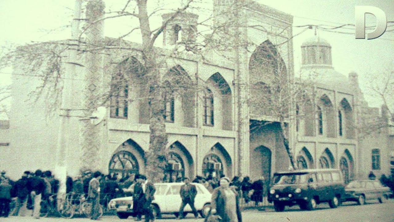
Namangan is a city in the Namangan region. The administrative, economic and cultural center of the region is ahead of Fergana in terms of population. It is one of the largest cities in Uzbekistan. It is the leading region of the Fergana valley in all respects. In the north of the valley, at the intersection of the Namangansoy with the Fergana canal, 450 It is located at an altitude of 83,300 km². The average temperature in July is 26.3°C, in January it is 2.3°C. The population is about 1 million people (2021).[1] Aksikat (Akhsikent), the ancient capital of the Fergana Valley, 1620 Due to the destruction caused by a strong earthquake in 1930, its inhabitants moved to the territory of the present-day city of Namangan. Namangan was formed near the salt mine (Namak kon), and the name of the city is mentioned for the first time in the historical documents of the Middle Ages. Zahiriddin Babur in his Baburnama (16th century ) mentioned the village of Namangan in his work. According to V. P. Nalivkin (A brief history of the Kokhan Khanate, Kazan, 1886), Namangan appears in foundation documents from 1643. In the 18th century, Namangan was subordinate to the Khanate of Kokhan. However, it has retained its importance as the residence of the governor of the region. It was a craft center that served not only the residents of the city, but also the residents of the surrounding districts. Peasants bought thread and gauze, copper vessels, jewelry and work tools in Namangan markets. Architecture has developed significantly in the city. Architectural monuments such as the mausoleum of Khoja Amin (17th century), Mulla Kyrgyz madrasa (1911-12) and Ota Valikhan Tora Mosque (20th century) still exist. In 1817-22, with the efforts of the people of Namangan, the large Yangariq canal was dug and the water supply was improved.In 1842-45, the city was surrounded by a high wall. F. Nazarov, a Russian officer who came to Namangan in 1813-14, discovered that there was a large garrison here in the walled palace of the city governor. It was the residence of Namangan bey until the last days of the Kokan Khanate. became one of the cities of the district. In 1894-95, state buildings were built for uyezd institutions. At the beginning of the 20th century, Namangan became a typical city of Central Asia with old and new parts. In 1912, a railway was built to the city by Kokan. In 1914, the number of factories reached 17. In addition, 2 oil factories were built. 22 out of every thousand people in the city were industrial workers. In 1916, in Namangan there was an uprising of workers against Nicholas II's decree on labor (see Labor). About 80% of enterprises in Namangan stopped working during the Bolshevik war of aggression. After the war, industrial enterprises began to recover and develop. Motor repair, milk - oil, canning, brick, cotton ginning factories, bread factory, power station and several small local industrial enterprises were put into operation. - led to the development of hunting products industry. During this period, 3 power plants, wine and beer factories, a spinning and weaving factory, and a repair-mechanic workshop were built in the city. The gross output of the industry increased year by year. cooperative industrial enterprises were launched. After the war, light, food, heavy, chemical, metallurgical, electrical engineering and construction industries developed. In 1946, the 2nd hydroelectric power station was built in Namangansoy in order to fully supply the city with electricity. In 1949, the Central Excavator Station was established, where various agricultural machines such as excavators, scrapers, bulldozers were repaired.
At the next session of the Regional Council of People's Deputies, which took place on March 5, 2021, it was announced that another district - the New Namangan district - will be established within the city of Namangan. The total land area of this district is 8223 hectares. It is planned to transfer 24 neighborhoods of the city to the district. Today, 145,000 people live in these neighborhoods [2]. On May 8, 2021, the Cabinet of Ministers adopted a decision On measures to resolve organizational issues related to the establishment of the New Namangan district within the Namangan city of Namangan region . In accordance with the decision, the administration of New Namangan district was established within the city of Namangan. In the document, it is noted that the department of justice, the center of public services and the bodies for writing civil status documents will be established in the district with the allocation of additional state units.
Historic and Beautiful the Namangan
Lorem Ipsum is simply dummy text of the printing and typesetting industry. Lorem Ipsum has been the industry's standard dummy text ever since the 1500s
.


Map of Namangan
Lorem Ipsum is simply dummy text of the printing and typesetting industry. Lorem Ipsum has been the industry's standard dummy text ever since the 1500s
.